Highland wildfire smoke blows into Aberdeen - 97 miles away
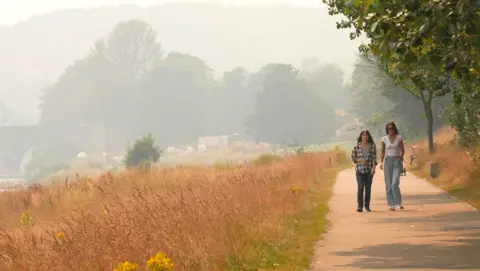
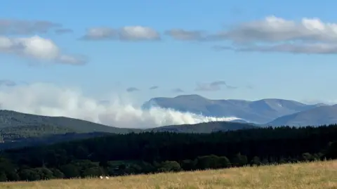
Smoke from a wildfire in the Cairngorms National Park can now be seen 97 miles away in Aberdeen following a change in wind direction.
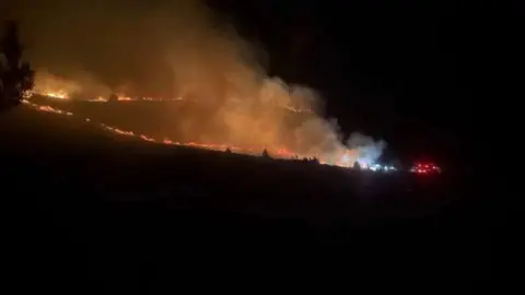
RSPB Scotland said the situation was "serious" again at its Abernethy reserve, following a "major flare-up" due to the change in conditions as the fire entered its 10th day.
The Scottish Fire and Rescue Service said residents and businesses in the east area of Aviemore, as well as across parts of Aberdeenshire - including Inverurie, Banchory and Kintore and surrounding areas - and as far as Aberdeen city, may see or smell smoke on Friday and into the weekend.
They advised anyone affected to keep windows and doors closed.
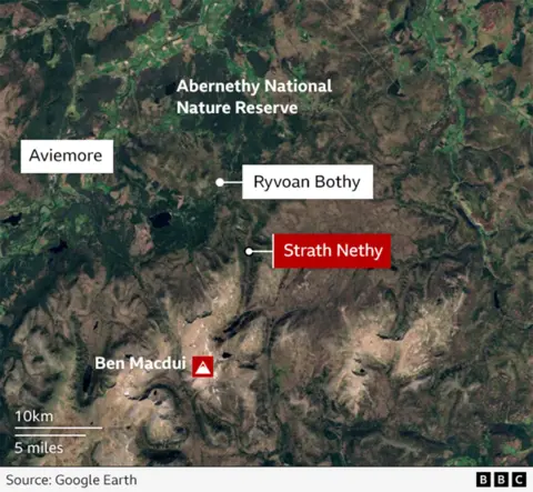
More than 100 firefighters have been tackling the blaze which first broke out near Ryvoan Bothy, south of Nethy Bridge, last Wednesday.
Eleven fire engines, wildlife units and a command support unit are still at the scene.
Firefighters said miles-long firebreaks had helped to contain the latest break-outs on Thursday night while drones were directing crews to hot spots.

The SFRS said the fire remained "dynamic and unpredictable".
A spokesman said: "Changing wind strength and direction can cause flare-ups, reignition and the spread of smoke, with conditions continuing to evolve.
"Firefighters remain deployed to tackle the incident across a vast and complex landscape, supported by ongoing helicopter water-bombing operations.
"Crews, specialist wildfire resources and partner agencies continue to monitor conditions closely and work to prevent further spread."
SFRS deputy assistant chief officer Michael Humphreys told BBC Radio Scotland there had been progress.
"Aviemore is very much open for business but we still have an exclusion zone in place around the actual operational incident," he said.
He said the affected area had been split into two main zones, west and east, to surround and contain the fire.
Firefighters and estate workers had cut down trees and vegetation and used tactical burning to create a 2.5miles (4km) firebreak on the west side and a 1.2mile (1.9km) firebreak on the east side, where the flare-up happened.
"So should a fire flare-up and move towards those areas, there is no longer any fuel there to burn," he said.
Teams have been given air support with helicopters waterbombing the area and drones to help identify where the fire is moving.
Despite road closures and police cordons, emergency services have continued to receive reports of visitors attempting to enter the affected area.
Humphreys asked the public to pay attention to signs and follow diversions.
"It's absolutely devastating for the local community and the wildlife," he said.
"We normally get a very high footfall in that area but please do avoid that area and keep yourself completely safe.
"We're continuing to make very good progress but it's still very much an ongoing incident."
RSPB Scotland said that over the last week there had been a "tireless effort" to tackle the blaze.
A spokesperson said: "Unfortunately, the fire threat has once again been growing at RSPB Abernethy since yesterday afternoon following a change in weather conditions.
"The situation is serious and staff, volunteers and partners are at this time are focused on doing all they can to support the Scottish Fire and Rescue Service who are co-ordinating the response."
She added that it was too early to understand the impact of the fire on the Caledonian pine forest.
"Abernethy is an incredible place for nature, and we are concerned about how wildlife may be faring," she said.
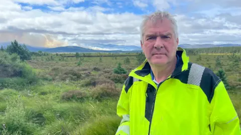
Sandy McCook, chairman of Nethy Community Council, said he had witnessed a "major flare-up" on Mam Suim, Craig nan Gall and into Strath Nethy on Thursday evening.
He said: "The wind has picked up considerably and turned to a more westerly direction driving the fire eastwards."
He told BBC Scotland News: "It has had a huge impact in the village. People are on edge. They're on tenterhooks.
"They don't know quite what's happening especially when they're seeing one thing on the ground and the agencies are putting out a different message."
He added: "We haven't had the air support that that we need. The other thing that would have made a huge difference would be if the government had declared a state of emergency or a critical incident.
"We could then have had the use of military assets."
He said he felt "sick to the pit of his stomach" at the situation.
The Cairngorms National Park covers 1,748 sq miles (4,527 sq km) and includes parts of five local authorities - Aberdeenshire, Angus, Highland, Moray and Perth & Kinross.
Closed and restricted areas include paths around Glenmore, Loch Morlich and Badaguish, as well as low-level routes including the Old Logging Way and routes providing access to Cairngorm Mountain, the Northern Corries, Meall A' Bhuachaille, the Green Loch (Lochan Uaine), Strath Nethy or Bynack More.
Paths within Abernethy Forest to the south of Forest Lodge towards Ryvoan Bothy also remain closed.